 modified.jpg)
...You are here: Home > More thoughts on deindustrialisation in Sydney
..More thoughts on deindustrialisation in Sydney
...John Muscat / Tuesday,13 June 2017
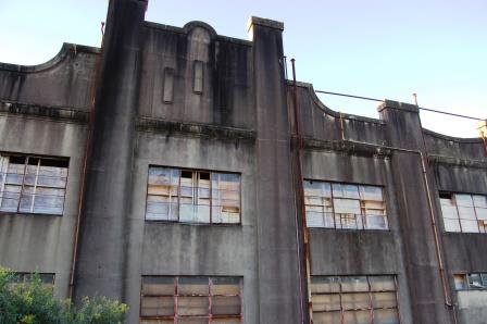
Derelict White Bay Power Station, western face, Rozelle, Sydney, 2017
Our last article on deindustrialisation in Sydney showed how escalating land values are contracting, dislocating and relocating the city’s industrial base. Boosted by price rises of more than 20 per cent a year in some places, residential development has become the highest and best land use across vast tracts of the greater metropolitan region. In old industrial zones like South Sydney and even middle-ring centres like Chullora and Wetherill Park, manufacturing and logistics operators are folding under pressure or moving to the western periphery.
But A Plan for Growing Sydney, the state’s urban planning strategy, is designed around the priorities of global knowledge workers, full of sentiments like “the Government will focus its support on growth in the knowledge economy” and “opportunities to grow knowledge jobs.” Questions are emerging about its capacity to deliver enough affordable, zoned and serviced land for a viable industrial sector.
While Sydney’s planning establishment and media are absorbed in ‘global city’ schemes like metro and light rail and mixed-use urban renewal, factories and warehouses arouse much less interest. From 2010 to 2015, the NSW Department of Planning published an annual Employment Land Development Program (ELDP) report full of useful statistics and commentary on the supply of industrial land. Few observers seem to care when the report was dropped after 2015 and replaced with a less informative compilation of statistics in spreadsheet form, renamed the Employment Land Development Monitor (ELDM).
Perhaps the reports delivered an inconvenient message. According to the 2010 edition, 60 percent of potential employment land (industrial land) was zoned but only 20 per cent of this zoned land was adequately serviced with water and sewer connections. The available 3 years supply of zoned and serviced land was “significantly short” of the accepted standard of 5 to 7 years in a high take-up rate scenario.
Forward to the 2015 report, and there was a measly 1.5 years supply under a high take-up rate and 2.8 years under an average take-up rate. The amount of zoned but undeveloped (vacant) land available for new activity in Greater Sydney shrank dramatically. At the time of the 2010 report there was 4,480 hectares, falling to 3,029 hectares in 2015 and, according to the ELDM, falling to 2,756 in 2016. More to the point, the amount of undeveloped land that was also serviced halved from 900 hectares in 2010 to 450 in 2015 and 497 in 2016.
Unlike the ELDP, the ELDM doesn’t benchmark zoned-serviced supply against various take-up rate scenarios. However in March, Colliers International published a report which tries to pick up where the ELDP series left off. Currently, says the report, there are 2,505 hectares of undeveloped-unserviced land and 423 hectares of undeveloped-serviced land, so the plunging trend in the ELDP and ELDM data continues.
Colliers assume a take-up rate of 155 hectares per annum (the 2008 to 2015 average) as the ‘base case’ and 270 hectares (highest take-up recorded over 2008 to 2015) as the ‘high case’. Combining the current 423 hectares of undeveloped-serviced with 50 percent of the 2,505 hectares of undeveloped-unserviced land, they estimate a total land supply of 1,676 hectares. That makes 6 years supply on the high case and 10 years on the base case. This estimate got some media coverage. Only half of the undeveloped-unserviced land was included to take into account planning changes and land needed for roads and infrastructure.
But Colliers repudiate the ELDP approach of only counting serviced land. On the ELDP methodology there would only be 1.5 years supply on the high case and 2.7 years on the base case, virtually unchanged since 2015.
Sydney may be entering a prolonged industrial land crisis. If supply is keeping ahead of demand, it’s by a thin margin and for apparently fortuitous, ad hoc reasons.
Agents L J Hooker suggest that only a recent upturn in land sales to developers saved Sydney’s market from “the risk of experiencing temporary bottlenecks in land supply.” And as at April this year, Knight Frank found that “Sydney’s industrial vacancy has reached its lowest level on record … down 21 per cent from the previous quarter.” Ominously for Colliers’ take-up rate projections, gross take-up for April was 18.5 per cent above the long term average.
CBRE’s review for first quarter 2017 also concludes that “vacancy and availability are tight and new industrial supply is struggling to meet demand.” Savills Research go even further, claiming that over the medium term “demand will continue to outpace supply as competition for land intensifies.”
These straightened conditions are setting land values and rents on fire. According to Savills, Sydney industrial land values soared 15 percent in the year to December 2016 and in Western Sydney, for example, average prime rents rose 6 percent. Pockets of Western Sydney and South Sydney recorded as much as a 50 percent uplift in values. “The reduction of land available for development and growth in land values should place upward pressure on rents over the medium term”, they report.
No less than 93 percent of Greater Sydney’s zoned and undeveloped industrial land is now concentrated in the south-west, west and central west subregions. Observers confirm a general trend for manufacturing and logistics operators to prefer western locations over old industrial hubs like Alexandria, Waterloo, Zetland, Mascot and Botany in South Sydney. Because, in part, voracious apartment builders gobbled up 27 percent of the south market’s undeveloped-serviced supply between 2010 and 2016, western land is still around 40 per cent cheaper than the Sydney average.
On the logistics side, moreover, the ‘next generation’ of storage and distribution facilities occupy larger lots, mostly available on vacant land in the peripheral west. The 2015 ELDP report points out that 92 percent of lots in the 1 to 5 hectare and above 10 hectare categories are located there.
“Outer Sydney has experienced strong growth relating to construction of new warehouse and distribution centres,” notes the 2015 ELDP report, “particularly within the Western Sydney Employment Area (WSEA) around the junction of the M4 and M7 motorways.” Says the report:
Constant growth in freight volumes and efficiency advancements are directing the need for new facilities in the transport and distribution subsector. Companies taking advantage of strategic locations have seen a noticeable rise in efficiency of distribution costs and time. A key efficiency driver in Sydney is that it contains vacant land particularly in the Outer West, which is in close proximity to motorways.
In their comprehensive overview for the NSW Department of Planning, consultants Urbis argue that road-building is the key to bringing more of the WSEA’s 10,700 hectares of industrial land onstream for development. “Due to the distance of the WSEA from key infrastructure nodes such as the port and airport, transport costs would be potentially higher … although motorway access would alleviate the effects of this distance.” In short, “road remains the most efficient method of moving freight in terms of both cost and time.” Urbis endorse the Westconnex Motorway, now under construction, and the planned Outer Sydney Orbital Corridor.
But road-building doesn’t top the NSW Government’s priority list. Under the influence of fads transmitted from writers like Richard Florida and Enrico Moretti to the local urban planning establishment, Sydney’s metropolitan strategy assumes that developed countries are in a post-industrial phase. Productivity and competitiveness come from attracting “skilled [knowledge] workers from around the world” to global cities with ‘sustainable’ services like metro and light rail networks. More specifically, public transport infrastructure should connect elite knowledge hubs like university campuses with the centres of highest social and cultural amenity, above all the CBD. In pursuit of this vision, the government is throwing most of its infrastructure budget at a new wave of urban commuter rail.
Now that the heavy-rail South-West Rail Link is finished for $2 billion, and the Inner-West Light Rail extension for $176 million, Sydney Metro Northwest is being rolled out for an estimated $8.3 billion. Sydney Metro City and Southwest will follow for $12.5 billion. Also underway is the $2.1 billion Sydney CBD and South-East Light Rail. Set to begin are Sydney Metro West at a cost of $10 billion, Parramatta Light Rail at around $3.5 billion and in time Western Sydney Airport Link for up to $25 billion, but probably less. Of course rail projects are notorious for overrunning their budgets, so the ultimate price tag for all this will be much higher. Incidentally, the government promises $4 billion for new Waratah trains and double-deck carriages to ease congestion on the heavy-rail system.
It’s no accident that these rail corridors link Sydney’s four major university campuses to the CBD. Metro Northwest will stop at Macquarie University in North Ryde on its way down to the harbour. CBD and South-East Light Rail starts near the University of NSW in Kensington and heads up towards the University of Sydney in Camperdown before reaching Circular Quay. And the western pole of Metro West will be close to the University of Western Sydney’s vertical campus at Parramatta.
Contrary to the ‘global city’ perspective, some of the world’s most successful high-tech and innovation clusters emerged from suburban road corridors. One of them is Sydney’s own celebrated Global Economic Corridor, which sprung out of the intersection of two major arterial roads, Epping Road and Lane Cove Road in North Ryde. As Joel Kotkin writes in his latest book Human City: Urbanism for the Rest of Us, “most tech employment remains firmly in suburbanized areas – with lower-density development and little in the way of transit usage – such as Silicon Valley, Raleigh-Durham, Orange County and Dallas-Forth Worth … [t]his trend can be seen in other tech developments around the world.”
The state government does have a western road-building program, but it pales by comparison to the rail splurge. So far a paltry $700 million has been allocated to a 10-year-long program for one new road and four upgrades called the Western Sydney Infrastructure Plan (WSIP). While the federal government pledged a further $2.9 billion, some of that may now be diverted to the Western Sydney Airport at Badgery’s Creek. The upgrades are of arterial roads and junctions surrounding the WSEA on various sides, Werrington Road, Bringelly Road, The Northern Road and Glenbrook Intersection. Only the Werrington Road upgrade is finished. Others are on the drawing board or under leisurely construction in stages, due for completion in the mid-2020s or later.
The WSIP’s new road is the M12, an extension of the Orbital Motorway Network crossing laterally along the WSEA’s southern border, joining the M7 to The Northern Road further west. The M9 or Outer Sydney Orbital, farther out from the WSEA’s western flank, isn’t part of the WSIP but features in the state’s planning strategy. Despite so much potential to integrate the WSEA and other industrial lands with Sydney’s transport system, both of these languish in the ‘planning phase’ basket (reports suggest that next week's state budget will grant them a pitiful $23 million in 'planning money').
True enough, after decades of delay, $16.8 billion is being spent to build the largely underground Westconnex Motorway around the eastern side of the metropolitan region. On completion in 2023, Westconnex will interpose vital connections between the M4, M5, Port Botany, the airport and the M7 in western Sydney. But to avoid choking off prospects for a wave of industrial growth, the city’s arterial road and motorway network must penetrate into the reservoirs of vacant land west of the M7.
On top of this, the WSEA concept is itself a problem, representing a type of meta-zoning or cantonisation in which the city is carved up into bounded ‘growth areas’ to constrain outward expansion and tie development to rail links. “Connect[ing] new homes to job-rich locations via good public transport” is central to the ‘global city’ vision. Yet growth boundaries curb land and building supply while generating higher values and rents, such as those currently sweeping across Sydney. The handful of large institutional investors and developers who bought up most WSEA land can benefit from land banking, or slowing the flow of serviced lots and development.
Shortages of developable land, a burgeoning warehouse sector and high rents appear to be squeezing factories in particular. Manufacturing has experienced “a continued decline in demand for industrial space”, says the 2015 ELDP report, and its share of industrial building approvals was a low 21 percent. SGS Economics and Planning estimate that Sydney’s manufacturing sector recorded a 0.1 percent decline in activity over 2015-2016.
This is all bad news for workers since, again according to the 2015 ELDP report, ‘employment land’ jobs accounted for around 27 per cent of the workforce in western subregions. Under a better land management system, appropriately zoned lots would be released on a graduated and open-ended basis in line with demand, without fixed peripheral boundaries. But this would have to be supported by an advancing trunk road and motorway grid.
Recent article: Deindustrialisation in Sydney
Recent article: Sydney lurches to housing affordability disaster
Like to comment? email thenewcity@live.com.au
More articles are here. Follow us on twitter or request our free email updates here.
Copyright© 2017, The New City. All rights reserved.